Twisted WorldTHE PARCEL ATLAS
Browser test world

Development atlas · October 10, 2026

A community made for walking.

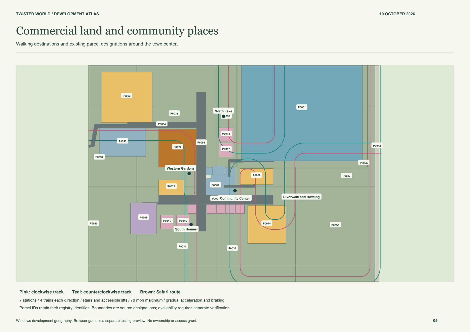
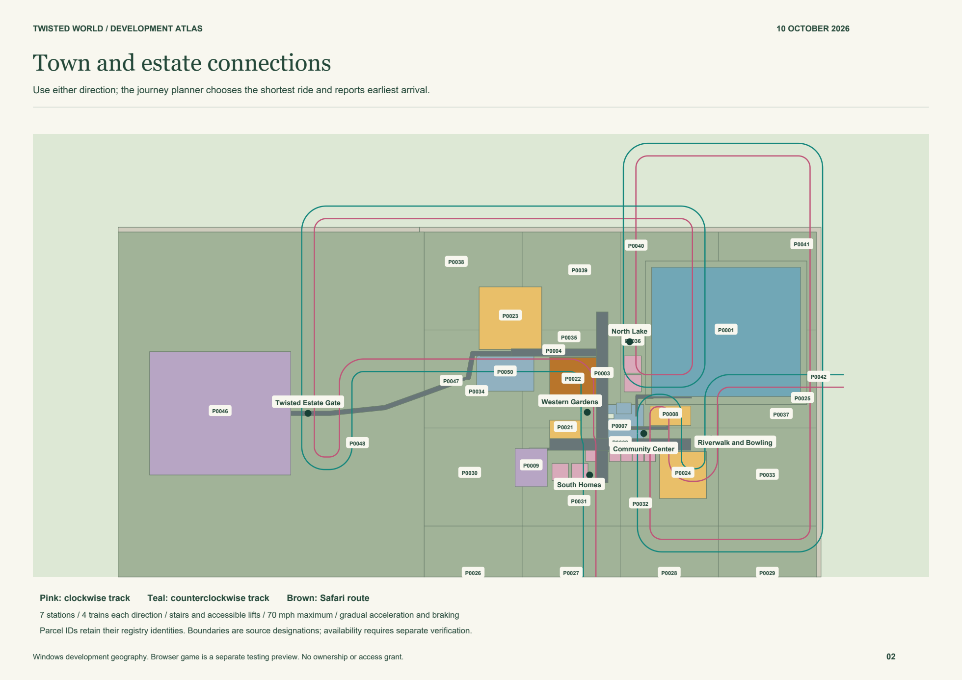
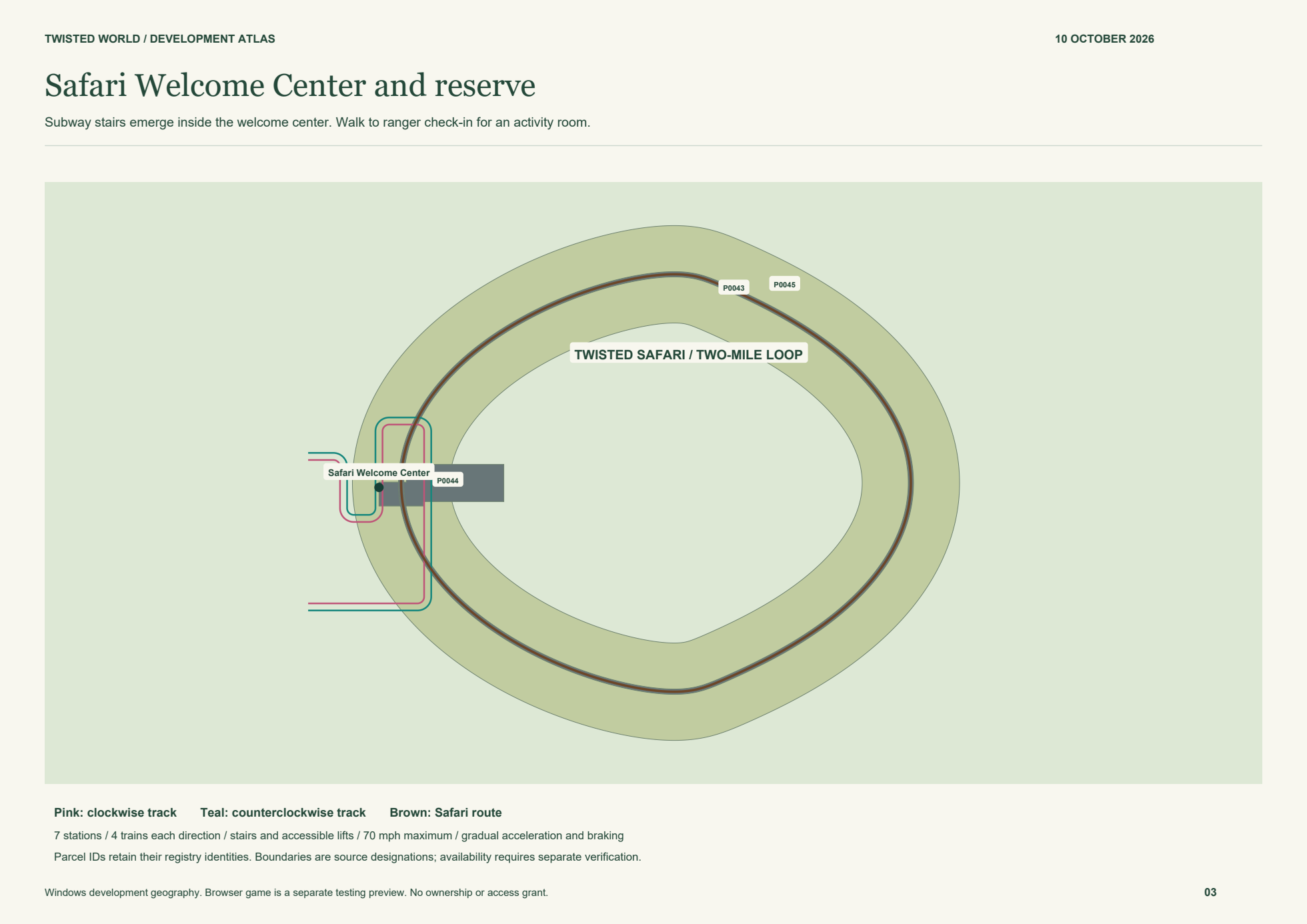
Follow pedestrian promenades, garden paths and the Riverwalk through the community. The safari now occupies real land east of town. Seven subway stops connect the community with four trains in each direction.

50designations
7estate acres
45original IDs retained
0confirmed available

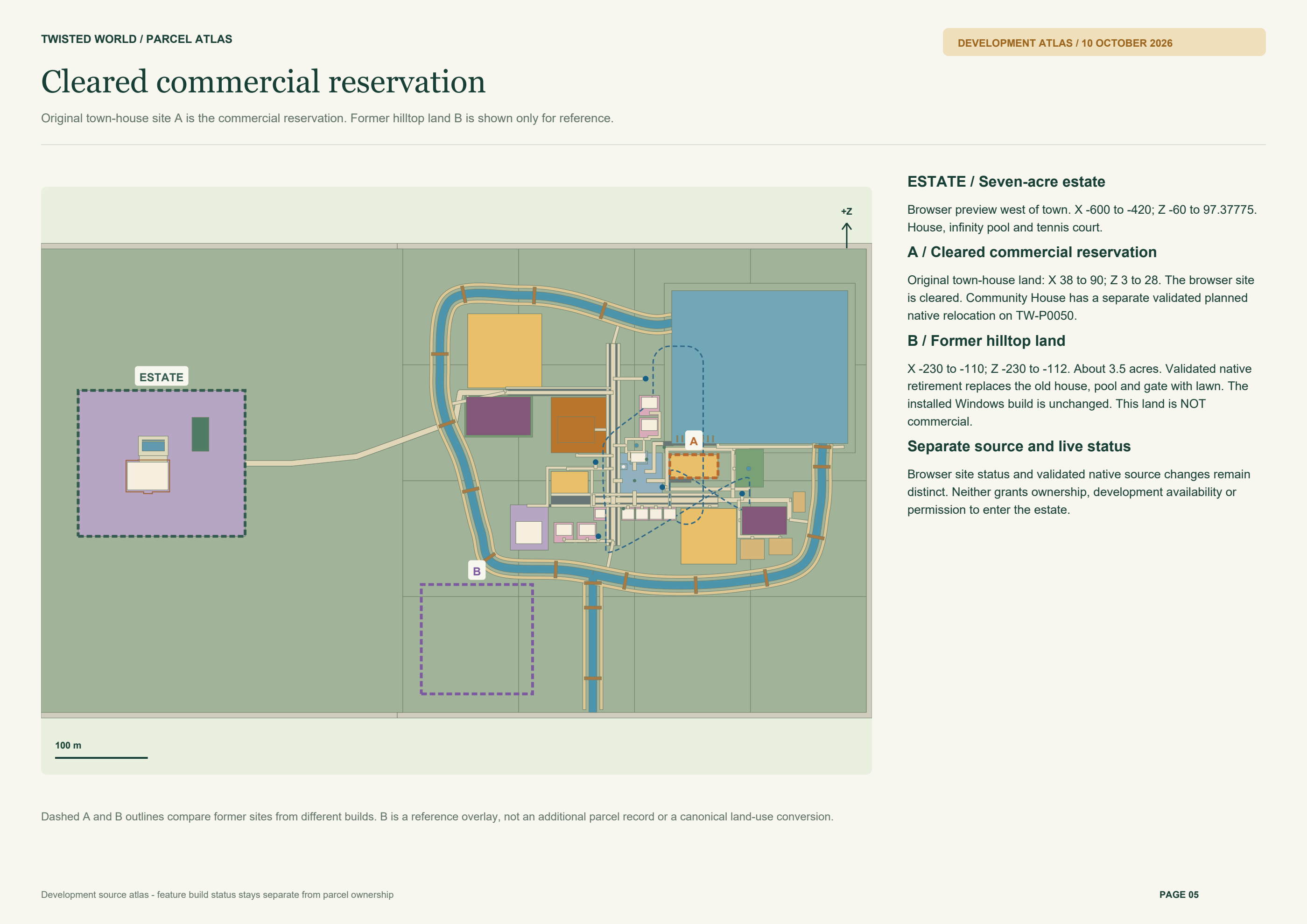
Development atlas · October 10, 2026. Browser release 0.1.0-alpha.20261010.7 includes physical Safari, bowling, seven subway stations and Community House. The matching Windows update is awaiting publication. Three commercial sites are planned; six superseded locations are historical and hidden by default. Source maps do not grant ownership, access or development availability.

Download development atlas ↓
Development atlas · PDF · 10 OctWorld overview · PNGRiverwalk and destinations · PNGExpanded town · PNGEstate detail · PNGCleared commercial site · PNGPhysical Safari reserve · PNGPlanning catalog · JSONPlanning catalog · CSVPortable interactive atlas · HTMLHistorical atlas · 5 Oct PDFSources and scope

Places by source. The physical safari and seven-stop subway reflect the current private Windows build. Older source overlays retain their build labels. Parcel boundaries remain separate from availability.

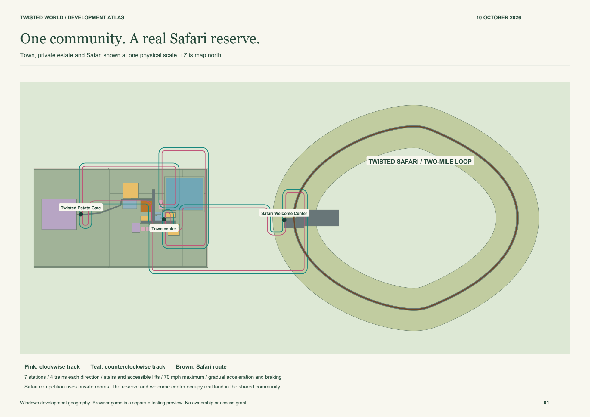
One physical world. Town and Safari share the same coordinates.
47 town + 3 protected Safari designationsSource overlays are identified by build. Safari lies east of town.
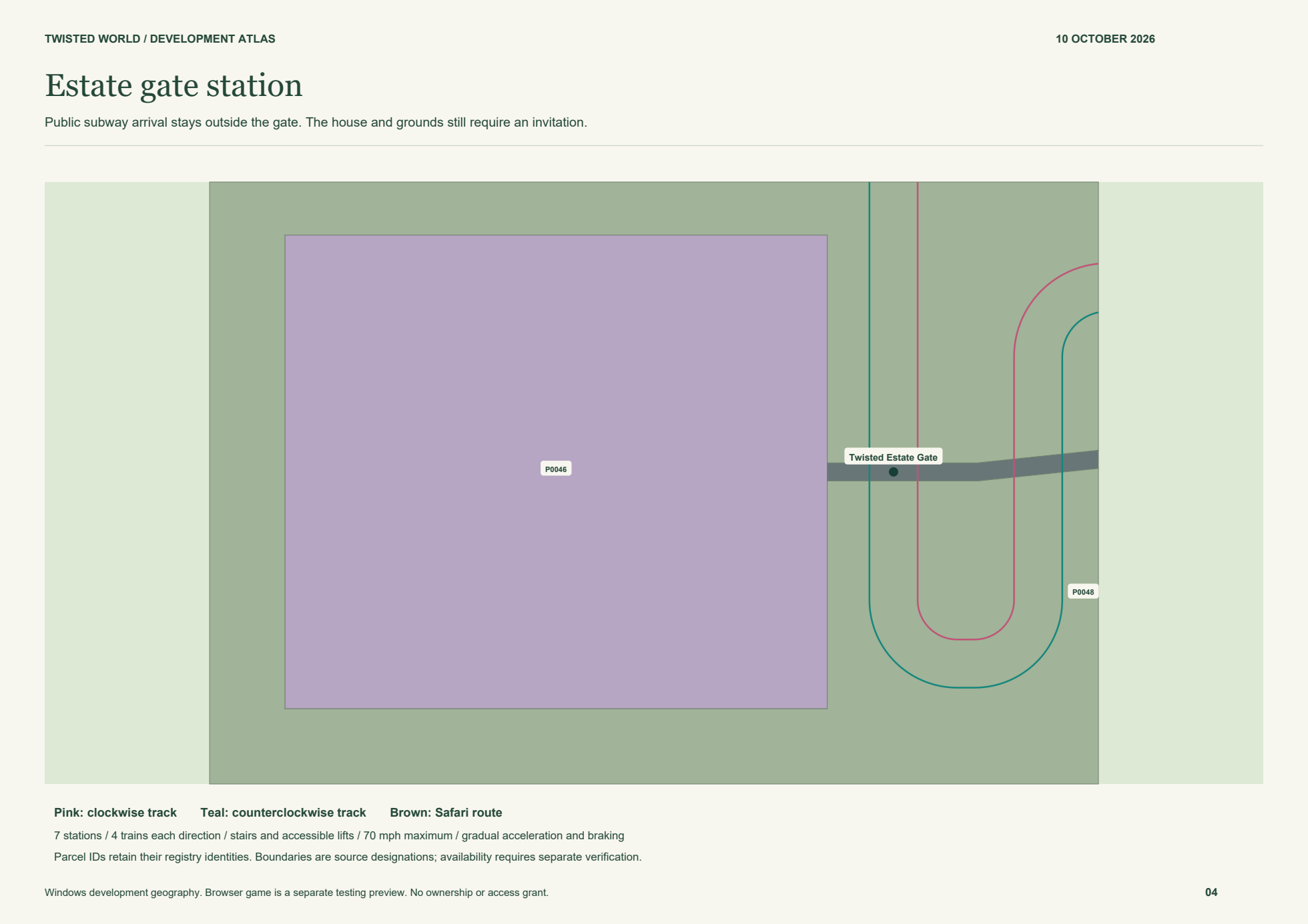
Development atlas: expanded town region and western seven-acre estate and out-of-town Safari in one coordinate system.

TW-P0019 is the Safari Welcome Center. Its subway stairs exit indoors; ranger check-in opens a private activity room.

↑+Zmap north
Drag to pan · Scroll or pinch to zoom
50 m